California Sampler by Dave Wyman
Dave Wyman's Gallery Dave Wyman's Gallery
×
  1. Dave Wyman's Gallery
  2. California Galleries
  3. California Sampler
Sierra Nevada Mountains - East Side Galleries
Yosemite National Park Galleries
California My Way
California Sampler
Sierra Nevada Summer
The Bristlecone Forest
The Carrizo Plain - California
The Central Coast of California Galleries
Backroads of Central California
Scroll across the monitor to see the entire image, rather than using one of the other sizing options.

The view is from the parking area near the Natural Bridge. Telescope Peak, standing 11,049 feet in elevation above sea level, and the snow-covered summits of the Panamint Mountains are to the west. The temporary lake, well below sea level, was created by some of that melting snow, plus a record winter rainfall in Death Valley in 2005.
Desert Wildflowers along Route 66, in the Mojave Desert between the communities of Newberry Springs and Ludlow. The flowers are growing, somewhat incongruously, in and around a vast lava field that flowed out of the nearby Pisgah Crater.
Death Valley
Two Temples of God:
Yosemite National Park and the Yosemite Chapel
Sunset over mud flats along the West End Road, a few moments before the sun dropped behind the Panamint Mountains.
This weekend I conducted a photography tour to the west side of the San Joaquin Valley, the Carrizo Plain National Monument, and the remote Cuyama and Lockwood Valleys. We enjoyed photographing two kinds of fields: enormous oil fields near the town of Taft - where we spent two nights - and spectacular fields of wildflowers. We also saw and even photographred some elusive wildlife.

This photograph was made this morning in the hills that rise south of Taft. The mountains in the background are part of the Transverse Range of California.
Our photography caravan ground to a halt when someone spotted these pronghorn antelope, at the Carrizo Plain National Monument. Though shy, the animals allowed us a little time to photograph them as they cavorted in the grass, before charging away.
"His Barber Shop" is in old downtown Taft, California. One of the photographers in our group spotted the sign in the window, while another gave this picture its somewhat sacreligious title.
An old Airstream trailer sits along Route 66 in the Mojave Desert.

More Route 66 photographs are at: http://www.pbase.com/davewyman/route6605
In a good year, like this one, the wildflowers are spectacular in the upper reaches along Klipstein Road, in the San Emigdio Mountains.
Expansion pipe in the oil fields near Taft, California. The insulated pipes will expand - less than an inch - to keep natural gas, oil and steam heated to different temperatures from damaging the system of pipes that run throughout the oild field.
California pumps a lot of oil - only Texas, Alaska and Lousiana produce more. This well is located near the town of Taft, in Kern County, which produces 10% of the petroleum production in the United States. It is, therefore, not surprsing that this rainbow, which I photographed in early April, ends in an oil field.
Wildflowers along Klipstein Road, south of Maricopa, California.
The wild Carrizo Plain is now a national monument. Home to many rare and endangered species, including sand hill cranes, tule elk, and antelopes, Carrizo can put on a showy display of wildflowers during the spring.
Thistle at the Carrizo Plain National Monument.
Along Klipstein Road, in the San Emigdio Mountains.
My new friend sits in front of the Old West bar at the truly remote and old Scheidek Resort, in Los Padres National Forest, on the fringe of the Cuyama Valley.

Photo note - I used Photoshop to blur out the background, not easy to do in-camera when using a 21mm lens.
Two days ago I rode my bike up into the Santa Monica Mountains, north of my home in the flatlands of Los Angeles. The sun was about to set over the city, and the wild mustard stood out against the dark background of the next ridge. While much of the mountain scenery has been developed in Los Angeles, there are still many places from which to take in fine views. This photo was made on Astral Drive, above Nichols Canyon.
Recent bike riding paid off for me, as I completed the Chico Wildflower Century today, a one-day, 100 mile bike ride in northern California. It was a long drive - almost 500 miles from my home in Los Angeles to the city of Chico. This is a picture of my friend Sam Chin, age 20, who came up with me to participate on his first century ride; he proved to be a very strong rider. Sam is my age when I first attended college at Chico State, 36 years ago.
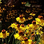
The Chico Wildflower Century is a one-day, 100 mile bike ride in northern California. A generous winter and spring rainfall meant there were indeed plenty of wildflowers.

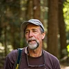
This is the top of volcanic Table Mesa, which my friends Sam and Silas and I, along with several thousand other riders, gained after some serious pedaling that took us up 1,200 feet above the floor of the Sacramento Valley. It was a mostly cool day, with overcast, but it didn't rain the finish of the ride.

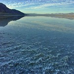
All that is left is the almost 500 mile drive back to my home in Los Angeles, in the southern half of the Golden State.
Wild mustard edges an irrigation canal, while flooded rice fields are visible in the distance, viewed along the back roads of the vast Sacramento Valley of northern California.
These wildflowers - goldfields - covered the landscape in the southern Cuyama Valley.
You find them all over the back roads - guard dogs, like this scary looking brute. The reality: he's a pussycat! Photographed alon Old HIghway 58, Barstow, in the Mojave Desert.
A rancher and the owner of the Schideck bar, near the Cuyama Badlands.
Red Rocks State Park, with its colorful and deeply eroded mudhills, is off of Highway 14, north of the desert town of Mojave. Dawn from the campground can be a very beautiful time to experience the park. This was quite a switch from my trip the prior weekend to the green and leafy hinterlands of northern California.
Don't shrink down this pano - four photographs stiched together - of Red Rock Canyon State Park to fill the monitor. Instead, use the "large" or "original" setting, so that this photograph can be scrolled across the monitor. Red Rocks is a strange place - these muhills, fossil beds, and amazing, blazing colors (however, the more colorful portions of the park are not visible in this photograph).
Red Rock Canyon State Park
Family-owned farms and ranches are supposedly dying out. It's not happening on this 600+ acre spread in northern California, where three generations of ranchers - and their sheep dogs - have worked the land.
This is a view of sunset over flooded rice fields along a backroad in the Sacramento Valley, in northern Califorina (between the towns of Chico and Willows). California grows and exports high-quality, medium grain japonica, a type of rice that is favored in Northeast Asia and in parts of the Middle East and Mediterranean region.
San Gabriel Mountains - Mount Baldy photographed from a pull-out along State Highway 2. This photograph appears in my book, Backroads of Southern California.
This is a California condor, one of the largest flying creatures on earth; the Andean condor is reputedly slightly larger. Adults can weigh up to 25 pounds and their wings can span almost 10 feet. State and federal programs have saved the condor - once down to about 15 birds in the wild - from extinction. Today, there are about 200 condors, many of them in rugged locations in California.

This is a somewhat special condor. From his markings, I could see that he was AC9, which stands for Adult... 
View More
Condor #9. He was the last condor to be taken from the wild.

After siring several chicks, he was returned to the wild. Condors have been significant to many American American groups, so AC9's release was celebrated with a Chumash Indian blessing.

I photographed AC9 in the beautiful Topa Topa mountains north of the little town of Filmore, and this portrait of him appears in my book about the backroads of Southern California.
Pano Experiment - I removed the background - hazy blue skies - from downtown Los Angeles, and in fact if it had been clear, the photo would have shown our local mountains topped with a fair amount of snow!
After warm weather followed by heavy rain, Yosemite Valley was innundated with snow-melted water on May 15. The sun came out on the morning of May 16. The Merced River, which runs through Yosemite Valley, became Yosemite Lake. The water here appears placid because it is so spread out, but the main body of the river was moving with some force. Thundering Yosemite Falls appears in the background and in reflection.

I have been in Yosemite Valley the last three times it saw major flooding. The first was the May, 1996 flood, and I was in the Valley the day it flooded on January 1, 1997 (we had two hours to spare before we would have been trapped for the next few days). This is the one flood I've been able to enjoy and photograph.
Another photograph showing the effect of the heavy snowpack, heavy spring rainfall, and unusually warm temperatures on Yosemite Valley. Instead of a ribbon of river running through the valley, there is a calm looking lake.
The Central Valley of California provides much of the food for the United States. At this time of year, fruit stands in the Central Valley are ubiquitous, like this one near Sangor. We had a great time purchasing strawberries from the nice woman behind the counter and then we ate the wonderfully fresh strawberries as we made our way down the Central Valley.
Tamarack Creek, Yosemite, runs wild during heavy spring run-off.
Ahwahnee Hotel, Yosemite - with the verdant vegetation and mist, the old hotel looks a bit like a castle lost in time.
Cascade Creek, Highway 120, Yosemite.
I found this little mushroom growing not far from mighty Yosemite Falls.
At the Pioneer Cemetery, Yosemite
At Happy Isles, Yosemite - an Incense Cedar resists the encroachment of the Merced River.
Seaweed - Montana de Oro State Park
Launching point for hang gliders in the Sierra Nevada Mountains.
A hang glider finds a rising column of warm air, soaring above the Ownes Lake after launching from the Sierra Nevada Mountains. Photo from my book, Backroads of Southern California.
The wildflower season in the desert, even the high desert, is over - but the image of the wildflowers in Joshua Tree National Park this year are staying with me.
;
Scroll To Top

Audio Mute
Prev
Play
Next
Shuffle
Include
Privacy and cookie policy
This site uses cookies to enhance your browsing experience, serve personalized content, and analyze traffic. By continuing to use this site you agree to use of cookies and stewardship of your data.