Dave Wyman's Gallery
Emigrant Highways - San Joaquin Valley, California
https://davewyman.slickpic.com/albums/Emigrant-Highways-San-Joaquin-Valley-California/photo/#3497422
Sunset Labor Camp
https://davewyman.slickpic.com/albums/Emigrant-Highways-San-Joaquin-Valley-California/photo/#3497421
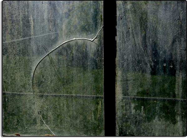
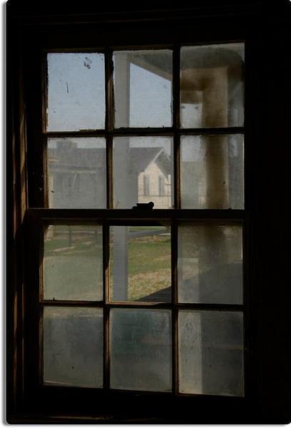
Cracked Window, Sunset Labor Camp
https://davewyman.slickpic.com/albums/Emigrant-Highways-San-Joaquin-Valley-California/photo/#3497420
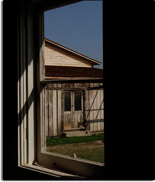
View at the Sunset Labor Camp
https://davewyman.slickpic.com/albums/Emigrant-Highways-San-Joaquin-Valley-California/photo/#3497419
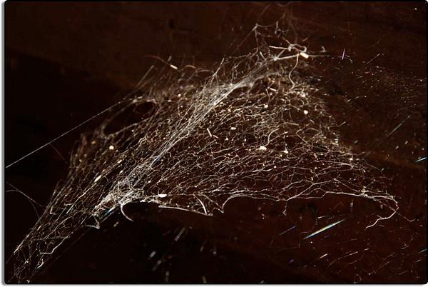
Cobwebs at the Sunset Labor Camp, Weedpatch, California
https://davewyman.slickpic.com/albums/Emigrant-Highways-San-Joaquin-Valley-California/photo/#3497418
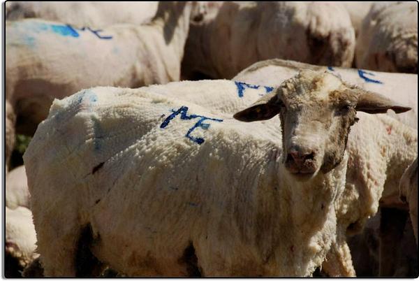
Summer Wear
https://davewyman.slickpic.com/albums/Emigrant-Highways-San-Joaquin-Valley-California/photo/#3497417
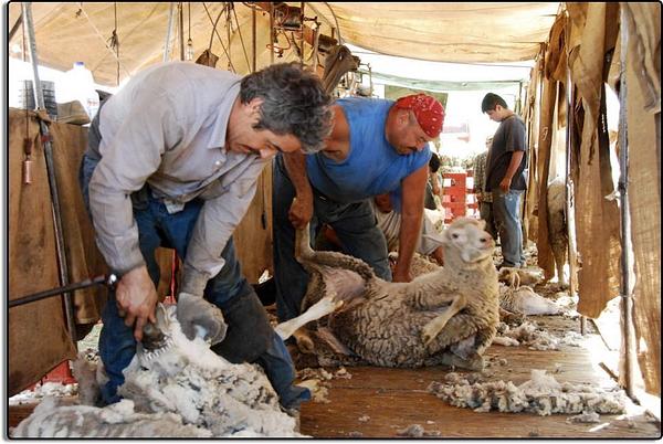
Sheep is Shorn
https://davewyman.slickpic.com/albums/Emigrant-Highways-San-Joaquin-Valley-California/photo/#3497415
Shearing Sheep
https://davewyman.slickpic.com/albums/Emigrant-Highways-San-Joaquin-Valley-California/photo/#3497414
Waiting their Turn
https://davewyman.slickpic.com/albums/Emigrant-Highways-San-Joaquin-Valley-California/photo/#3497413
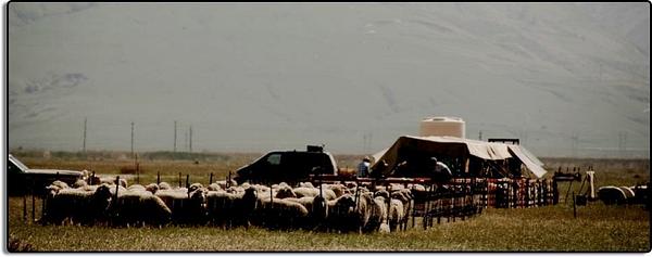
Sheep Shearing Encampment
https://davewyman.slickpic.com/albums/Emigrant-Highways-San-Joaquin-Valley-California/photo/#3497412
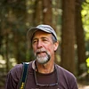
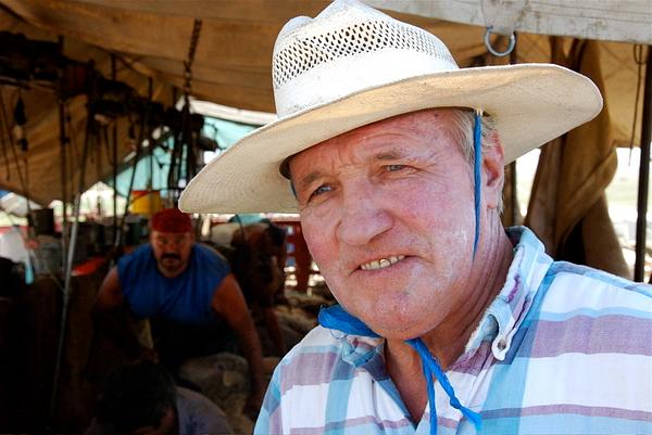
Martin Etchamendy, Basque Sheep Rancher
https://davewyman.slickpic.com/albums/Emigrant-Highways-San-Joaquin-Valley-California/photo/#3497411
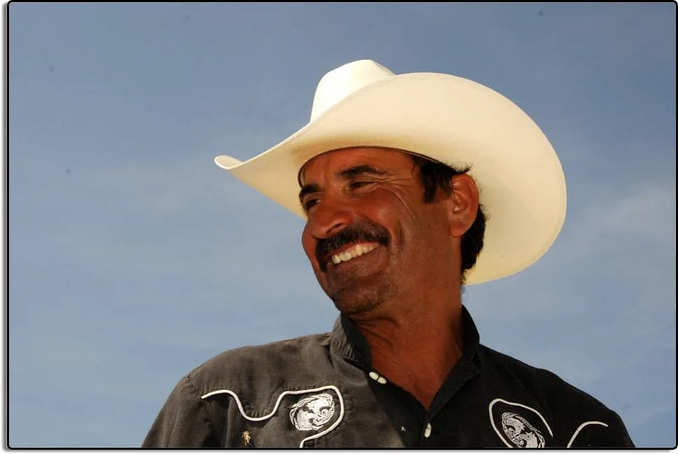
Cowboy near Lamont, California
https://davewyman.slickpic.com/albums/Emigrant-Highways-San-Joaquin-Valley-California/photo/#3497410
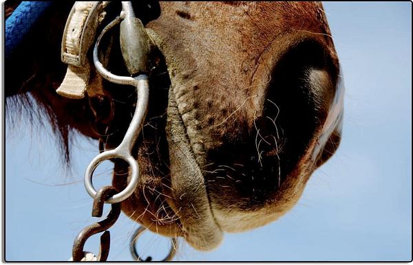
Albertos Horse
https://davewyman.slickpic.com/albums/Emigrant-Highways-San-Joaquin-Valley-California/photo/#3497409
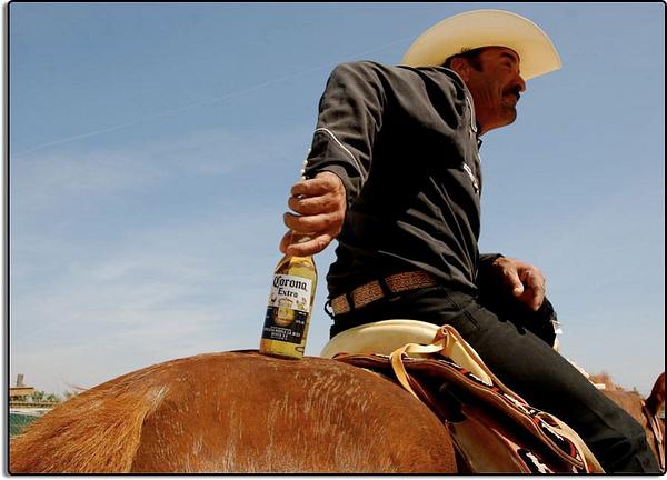
The Good Life A cowboy, his horse, and a Corona! Photographed on a relaxing Sunday northeast of Bakersfield, California.
https://davewyman.slickpic.com/albums/Emigrant-Highways-San-Joaquin-Valley-California/photo/#3497408
Child and her Mother Near Keene
https://davewyman.slickpic.com/albums/Emigrant-Highways-San-Joaquin-Valley-California/photo/#3497406
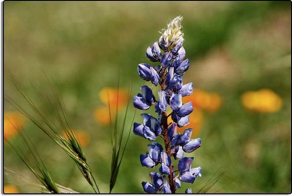
Lupine along Highway 223
https://davewyman.slickpic.com/albums/Emigrant-Highways-San-Joaquin-Valley-California/photo/#3497405
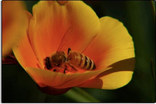
Poppy with Honey Bee
https://davewyman.slickpic.com/albums/Emigrant-Highways-San-Joaquin-Valley-California/photo/#3497404
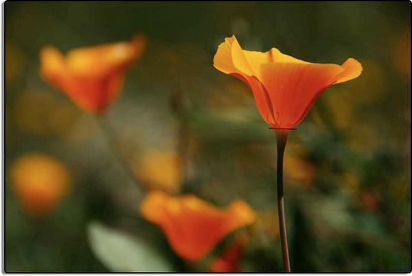
Poppies Near Arvin, California
https://davewyman.slickpic.com/albums/Emigrant-Highways-San-Joaquin-Valley-California/photo/#3497402
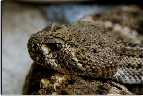
Western Diamondback Rattlesnake
https://davewyman.slickpic.com/albums/Emigrant-Highways-San-Joaquin-Valley-California/photo/#3497401
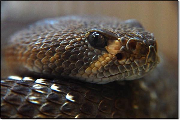
Southern Pacific Rattlesnake For those who've asked, below, how I managed to come so close to my subject with a camera, indeed, I was bitten and as a result I did die.
https://davewyman.slickpic.com/albums/Emigrant-Highways-San-Joaquin-Valley-California/photo/#3497400
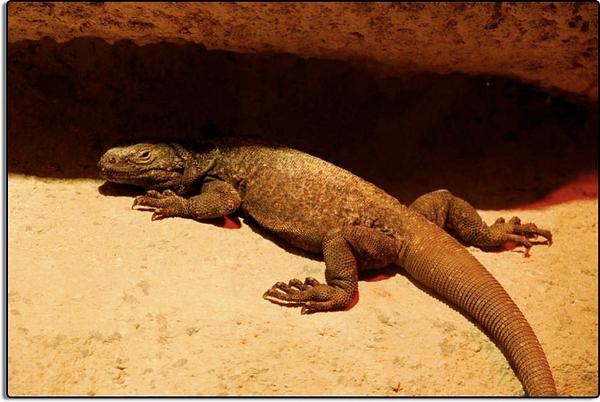
Chuckwalla
https://davewyman.slickpic.com/albums/Emigrant-Highways-San-Joaquin-Valley-California/photo/#3497399
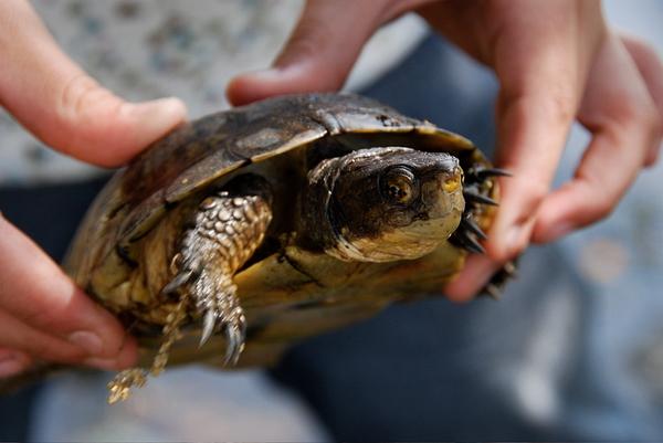
Turtle with Young Friend
https://davewyman.slickpic.com/albums/Emigrant-Highways-San-Joaquin-Valley-California/photo/#3497398
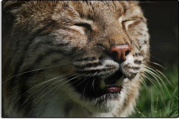
Happy Bobcat, California Living Museum This bobcat, one of two in captivity at the zoo, was behind a wire screen. I was able to render that wire invisible by leaning close to it with a long lens - 400mm - while using the largest f/stop possible - f/5.6.
https://davewyman.slickpic.com/albums/Emigrant-Highways-San-Joaquin-Valley-California/photo/#3497397
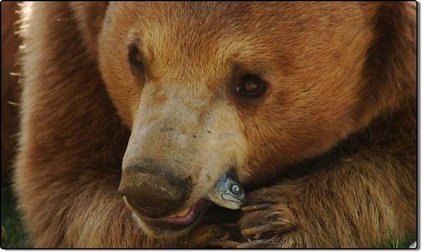
Black Bear with Lunch, California Living Museum
https://davewyman.slickpic.com/albums/Emigrant-Highways-San-Joaquin-Valley-California/photo/#3497396
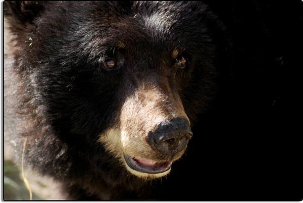
Black Bear at the California Living Museum, near Bakersfield
https://davewyman.slickpic.com/albums/Emigrant-Highways-San-Joaquin-Valley-California/photo/#3497395
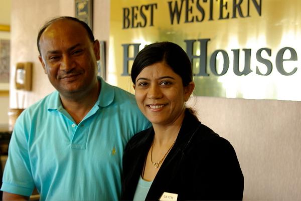
Our Hosts at the Best Western We stayed at the pleasant Best Western Motel, very near downtown Bakersfield. The innkeepers are from India.
https://davewyman.slickpic.com/albums/Emigrant-Highways-San-Joaquin-Valley-California/photo/#3497394
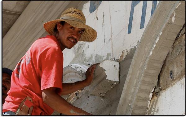
Renovation in Arvin, California
https://davewyman.slickpic.com/albums/Emigrant-Highways-San-Joaquin-Valley-California/photo/#3497393
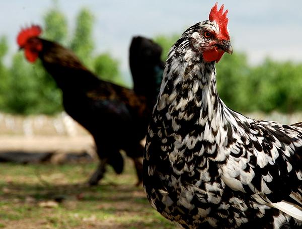
chickens.jpg
https://davewyman.slickpic.com/albums/Emigrant-Highways-San-Joaquin-Valley-California/photo/#3497392
Caesar Chavez Memorial
https://davewyman.slickpic.com/albums/Emigrant-Highways-San-Joaquin-Valley-California/photo/#3497391
Caesar Chavez Gravesite
https://davewyman.slickpic.com/albums/Emigrant-Highways-San-Joaquin-Valley-California/photo/#3497390
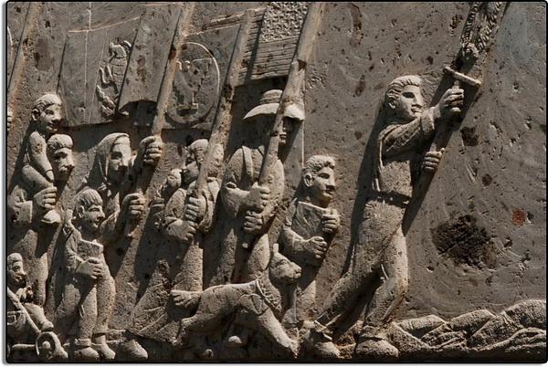
Abstract Patterns on a Disc Machine
https://davewyman.slickpic.com/albums/Emigrant-Highways-San-Joaquin-Valley-California/photo/#3497389
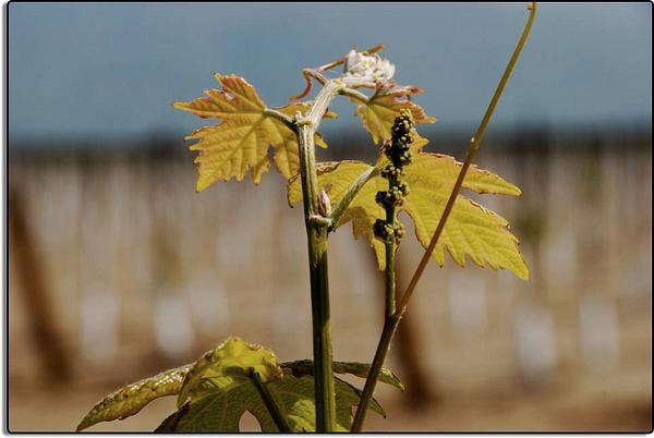
New Grapes
https://davewyman.slickpic.com/albums/Emigrant-Highways-San-Joaquin-Valley-California/photo/#3497388
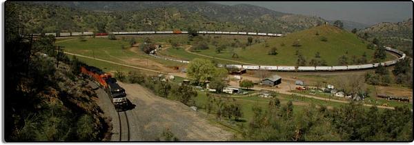
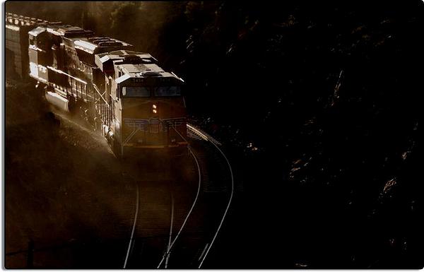
The Tehachapi Loop
https://davewyman.slickpic.com/albums/Emigrant-Highways-San-Joaquin-Valley-California/photo/#3497386
Locomotive on the Tehachapi Loop
https://davewyman.slickpic.com/albums/Emigrant-Highways-San-Joaquin-Valley-California/photo/#3497385
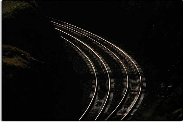
Tracks, Tehachapi Loop
https://davewyman.slickpic.com/albums/Emigrant-Highways-San-Joaquin-Valley-California/photo/#3497384
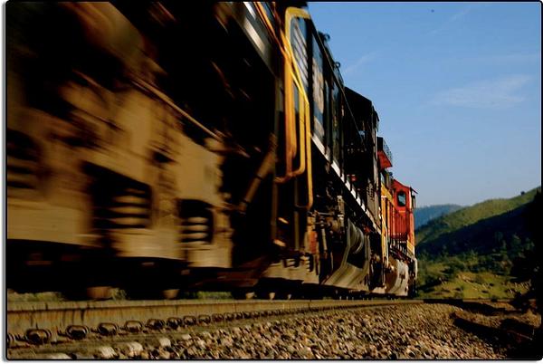
Tehachapi Loop
https://davewyman.slickpic.com/albums/Emigrant-Highways-San-Joaquin-Valley-California/photo/#3497383
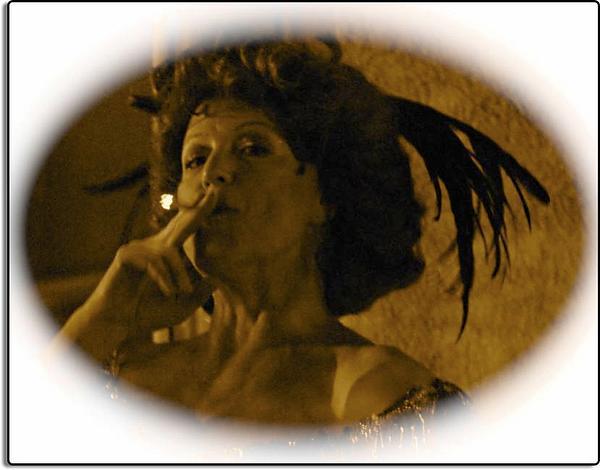
Hello, Dolly! Actress Leslie Lane
https://davewyman.slickpic.com/albums/Emigrant-Highways-San-Joaquin-Valley-California/photo/#3497382
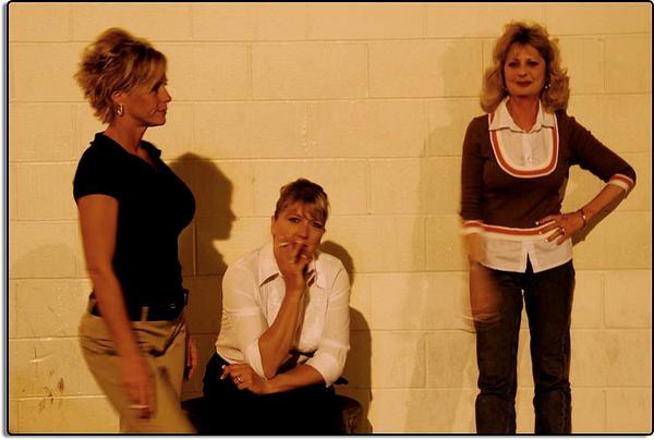
Waitresses on Break, Basque Restaurant, Bakersfield
https://davewyman.slickpic.com/albums/Emigrant-Highways-San-Joaquin-Valley-California/photo/#3497381
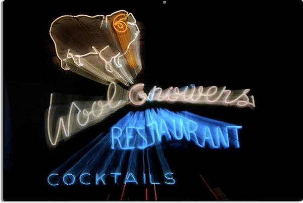
Zooming in on the Wool Growers Restaurant, Bakersfield During a 1 second exposure, I zoomed out on the camera lens (shrinking the image) on the neon sign over the what is probably the best Basque restaurant in Bakersfield. The effect makes it appear the sign is moving toward the viewer.
https://davewyman.slickpic.com/albums/Emigrant-Highways-San-Joaquin-Valley-California/photo/#3497380
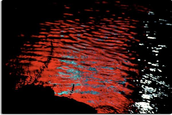
Neon Reflected in an Irrigation Canal, Bakersfield
https://davewyman.slickpic.com/albums/Emigrant-Highways-San-Joaquin-Valley-California/photo/#3497379
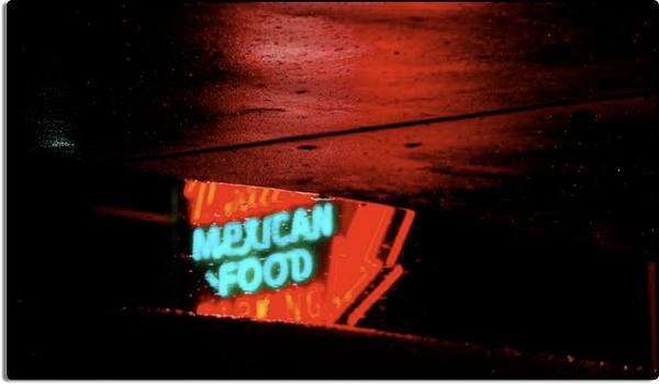
Street Reflection
https://davewyman.slickpic.com/albums/Emigrant-Highways-San-Joaquin-Valley-California/photo/#3497378
Alley Cat Bar
https://davewyman.slickpic.com/albums/Emigrant-Highways-San-Joaquin-Valley-California/photo/#3497377
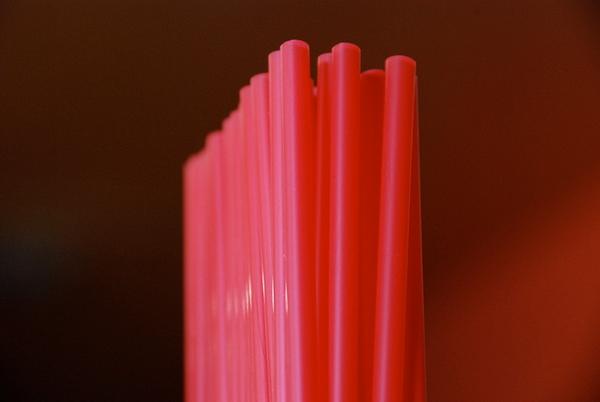
Straws Inside the Nile Theater
https://davewyman.slickpic.com/albums/Emigrant-Highways-San-Joaquin-Valley-California/photo/#3497376
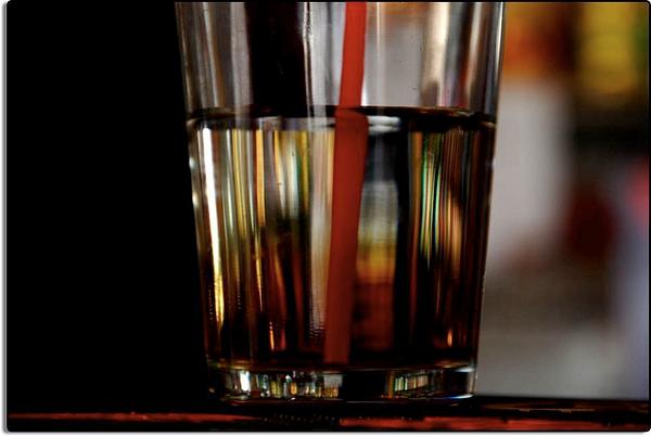
Half Full or Half Empty?
https://davewyman.slickpic.com/albums/Emigrant-Highways-San-Joaquin-Valley-California/photo/#3497375
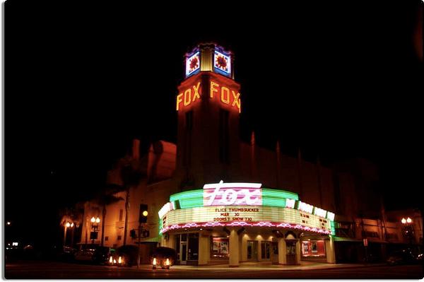
Fox Theater, Bakersfield
https://davewyman.slickpic.com/albums/Emigrant-Highways-San-Joaquin-Valley-California/photo/#3497374
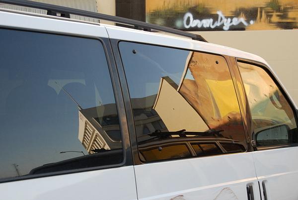
Mural Reflection, Bakersfied
https://davewyman.slickpic.com/albums/Emigrant-Highways-San-Joaquin-Valley-California/photo/#3497373
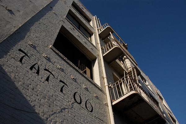
Get Your Tat!
https://davewyman.slickpic.com/albums/Emigrant-Highways-San-Joaquin-Valley-California/photo/#3497372
Fox Theater, Bakersfield
https://davewyman.slickpic.com/albums/Emigrant-Highways-San-Joaquin-Valley-California/photo/#3497371
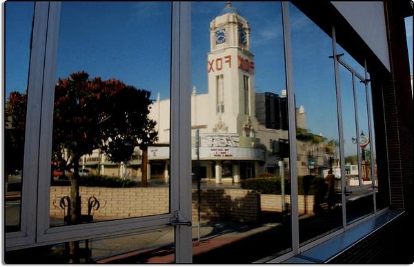
Fox Theater in Reflection, Bakersfield
Sunset Labor Camp
300 views
Cracked Window, Sunset Labor Camp
291 views
View at the Sunset Labor Camp
293 views
Cobwebs at the Sunset Labor Camp, Weedpatch, California
294 views
Waiting their Turn
293 views
Sheep Shearing Encampment
292 views
Martin Etchamendy, Basque Sheep Rancher
463 views
Cowboy near Lamont, California
318 views
Child and her Mother Near Keene
305 views
Lupine along Highway 223
305 views
Poppy with Honey Bee
78 views
Poppies Near Arvin, California
98 views
Western Diamondback Rattlesnake
77 views
Southern Pacific Rattlesnake
75 views
Turtle with Young Friend
75 views
Happy Bobcat, California Living Museum
76 views
Black Bear with Lunch, California Living Museum
74 views
Black Bear at the California Living Museum, near Bakersfield
71 views
Our Hosts at the Best Western
72 views
Renovation in Arvin, California
76 views
Caesar Chavez Memorial
72 views
Caesar Chavez Gravesite
68 views
Abstract Patterns on a Disc Machine
67 views
The Tehachapi Loop
63 views
Locomotive on the Tehachapi Loop
64 views
Tracks, Tehachapi Loop
60 views
Hello, Dolly! Actress Leslie Lane
70 views
Waitresses on Break, Basque Restaurant, Bakersfield
64 views
Zooming in on the Wool Growers Restaurant, Bakersfield
63 views
Neon Reflected in an Irrigation Canal, Bakersfield
62 views
Street Reflection
62 views
Straws Inside the Nile Theater
62 views
Half Full or Half Empty?
62 views
Fox Theater, Bakersfield
63 views
Mural Reflection, Bakersfied
62 views
Fox Theater, Bakersfield
76 views
Fox Theater in Reflection, Bakersfield
73 views
Scroll To Top 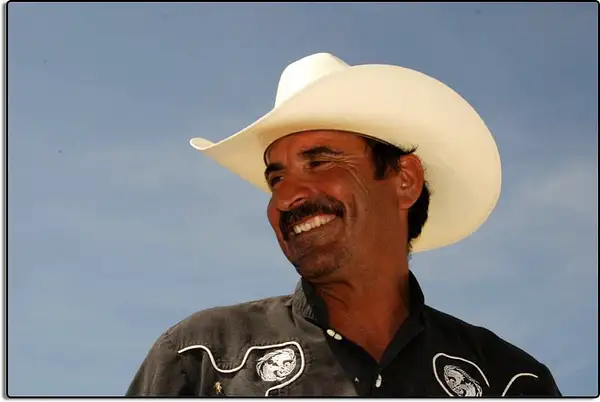


No comments yet...
All fields are required, fill in the form.
Comment successfully added.
Comment